


We provide programming assistance, in particular in the area of:
-
Python 3
-
JavaScript
-
PHP
-
HTML/CSS
-
XAMARIN
-
MySQL

We provide programming assistance, in particular in the area of:
We provide on-line consulting services in the field of:

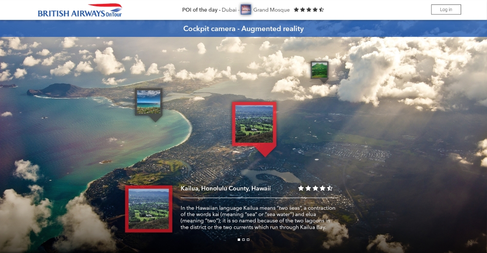
We have extensive experience in the implementation of mobile applications and systems using the Augmented Reality. We conducted several national and international projects based on this modern technology.
We provide full project support: starting from the concept, through graphics and development, ending with analyses and implementation. We also integrate existing devices or systems by coupling them with AR technology.
We specialize mainly in applications for iOS and Android platforms.
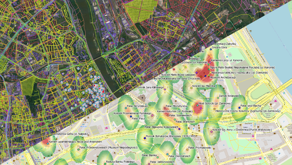
We create and support mapping services available on the Internet. The service includes:
- comprehensive implementation of the event's website
- integration of the website with social media such as: Facebook, YouTube or Twitter
- option of embedding a map service on the customer’s website
- clear presentation of spatial and descriptive data in a map form
- compliance with the OGC standards and the guidelines of the INSPIRE Directive
