


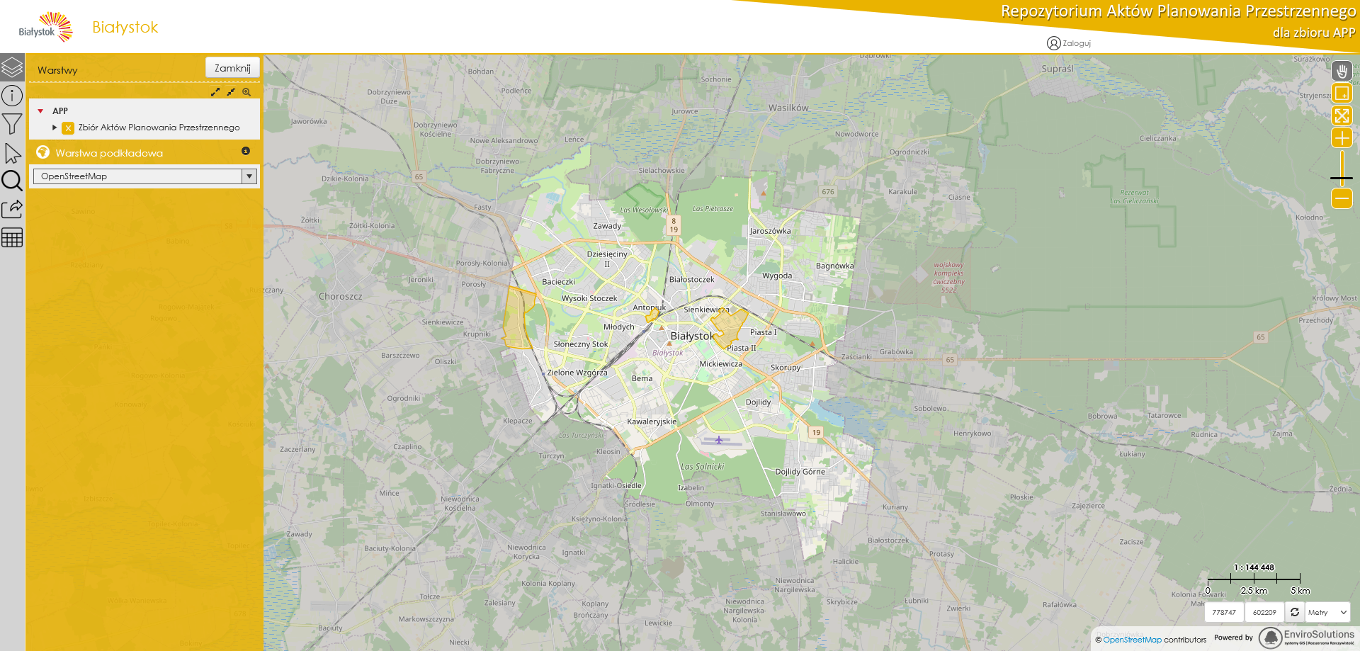
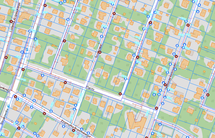
Implementation of the RAPP platform for the Bialystok city to administer and publish digital planning documents in a vector (XML/GML, shp) and raster data formats (GeoTIFF, WMS/WMTS).
website: RAPP Bialystok
Implementation of the RAPP platform for the Bialystok city to administer and publish digital planning documents in a vector (XML/GML, shp) and raster data formats (GeoTIFF, WMS/WMTS).
website: RAPP Bialystok
Development and implementation of a GIS class system for managing network assets at GPWiK Izabelin "Mokre Łąki" Sp. z o. o. ", enabling: keeping records of the company's network and facility assets, handling events on water and sewage networks, supporting technical processes...
website: Mokre Laki
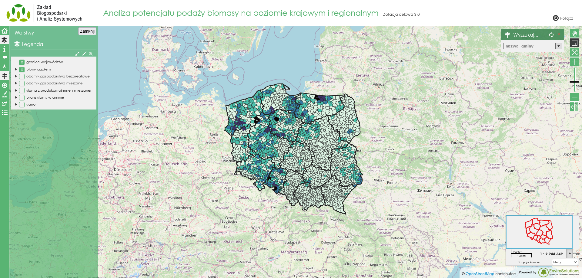
Platform supporting the development of the bioeconomy in Poland. One of its elements is a set of thematic geoportals based on an open-source web application – Lizmap. The project was commissioned by the Institute of Soil Science and Plant Cultivation – State Research Institute.
website: Bioeconomy platform
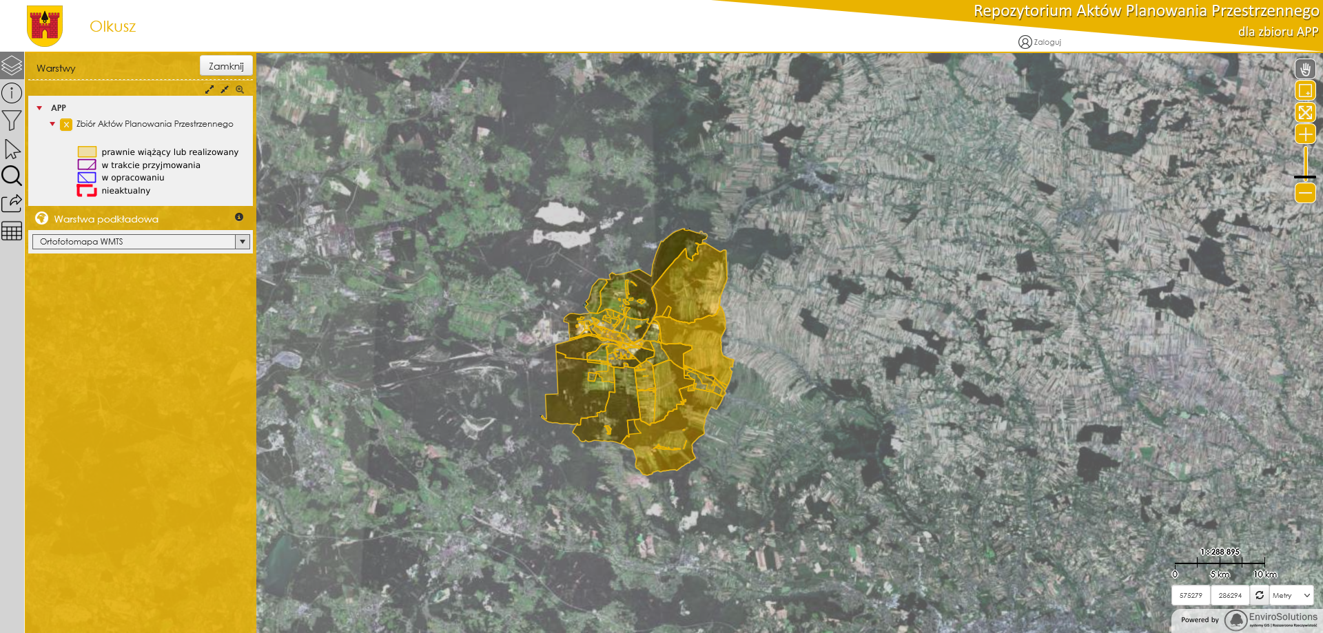
Implementation of the RAPP platform for the Olkusz commune to administer and publish digital planning documents in a vector (XML/GML, shp) and raster data formats (GeoTIFF, WMS/WMTS).
website: RAPP Olkusz
Implementation of the map module for viewing and managing spatial data.
RolnikON is an innovative solution for every farm. System helps to effectively manage: cultivation, stored materials, livestock, and thus also the energy and time. RolnikON was created for people who want to increase the efficiency of their agricultural activities in a simple way. Platform stores data about content of biochar and moisture in the soil.
website: Rolnikon

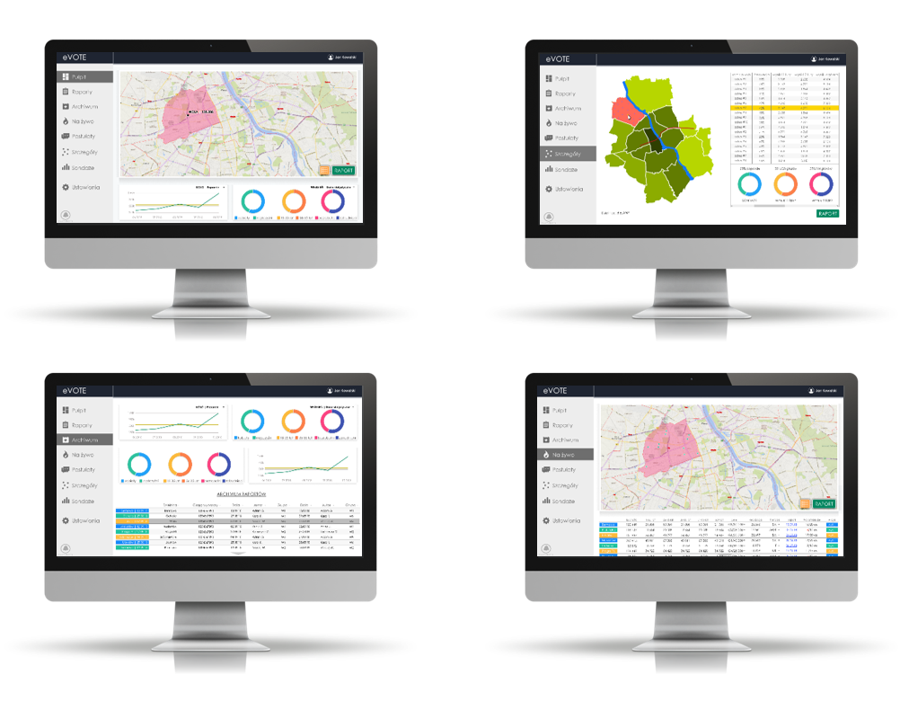
System for managing pre-election activities of a political party. eVOTE presents live information collected by volunteers and field workers. System allows to generate geo-reports, archive the collected information, visualize statistical data or carry out surveys. The platform integrates Web Map Application with mobile app.
The Interactive Startup Map has been divided into 4 thematic categories, closely related to the trends on the Polish startup market. It was established as part of the Entrepreneurship Development Program, commissioned by the Citi Handlowy bank in cooperation with the Studyinn Foundation.
website: Startup Map
A conceptual application for the city of Toruń using the Augmented Reality and elements of gamification.
It provides information on the location of historical and characteristic objects of a given city or region in an intuitive way. The user can determine the radius of searching for objects and then check their position in space without moving anywhere.
download: CityGuideTour

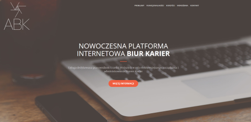
The project included building and implementing a dedicated platform for students, employers and employees of the Careers Office of the Warsaw University of Technology. The website allows employers to post job offers and students to view them. Employees of the Office use the portal to create newsletters, manage events and databases of employers and students, automate bookings for office hours, generate reports and statistics, and communicate with employers, graduates and students.
website: Careers Office
Mobile application integrated with renewable energy devices, displaying statistical data about: electricity consumption, electricity generation from wind and solar farms. Application has also a savings calculator related to the use of renewable energy sources.

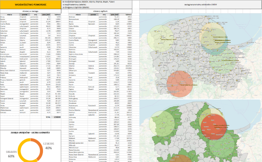
Creating advanced georeports - combination of statistical data presented in tabular form (Excel) and of map studies (QGIS). The implementation was aimed at presenting spatial and numerical relations for the needs of the Central Office of Measures.
office website: Central Office of Measures
Mobile application for participants of car rallies used for navigating the route. RB Reader allows the administrator to create and share routes. The use of the location modules embedded in the mobile device allows users to measure traveled distance and speed. The application facilitates use of touch interface or dedicated external devices to switch between route segments.
After completing the route, it generates a GPX file with the option of saving it on the device and sending to the organizer of the rally.
download: RB reader Android | RB Reader iOS

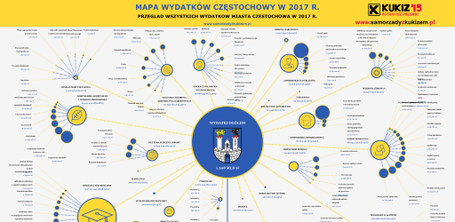
Generator of expenditure maps for local government units.
After entering the revenues and expenses into the form, a map of expenses is generated in the form of SVG vector graphics. Graphics are generated based on actual numeric values. The scale of the icons is preserved.
generator: Map Generator
Installation and configuration of network services server for sharing maps (WMS, WFS, WCS, WMTS, etc.). The service of providing current and annually updated orthophotoplan for municipalities in the form of a network service, which allows access to the product independent of software and for many users at the same time.
company website: Fotoraporty
